Liberty RiderLiberty Rider
Moto GPS
Roadbooks
Accident SOSPartners

BALADE JUSQU'À ANNONAY

Published on 5/28/2025
Distance
185 km
Duration
3h26
Difficulty
Intermediate
0 review
Navigate
Adapt

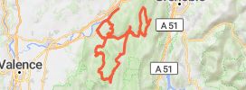
THURINS CHAPONOST SAINT GENIS LAVAL VOURLES VERNAISON GRIGNY GIVORS RIVE DE GIER SAINTE CROIX EN JAREZ LA TERRASSE DE DORLAY LE COL DE L'OEILLON LE BESSAT LE COL DE LA REPUBLIQUE BOURG L'ARGENTAL ANNONAY FELINES MACLES MALLEVAL CONDRIEU LES HAIES GIVORS MORNANT LES SEPT CHEMINS ORLIENAS THURINS 200KMS

How does it work?
  1. Save this Roadbook for navigation
  2. Find it in the GPS of the app
  3. Let yourself be guided, it's free.
Google PlayApp Store

Riders Reviews on this trip

Road surface
Scenery
Curves
Points of interest

Pictures of the motorcycle ride

BALADE JUSQU'À ANNONAY 1BALADE JUSQU'À ANNONAY 2BALADE JUSQU'À ANNONAY 3BALADE JUSQU'À ANNONAY 4BALADE JUSQU'À ANNONAY 5

Your review

Global rating

0 comment

All motorcycle trips Grenoble
Liberty Rider • All rights reserved • 2025